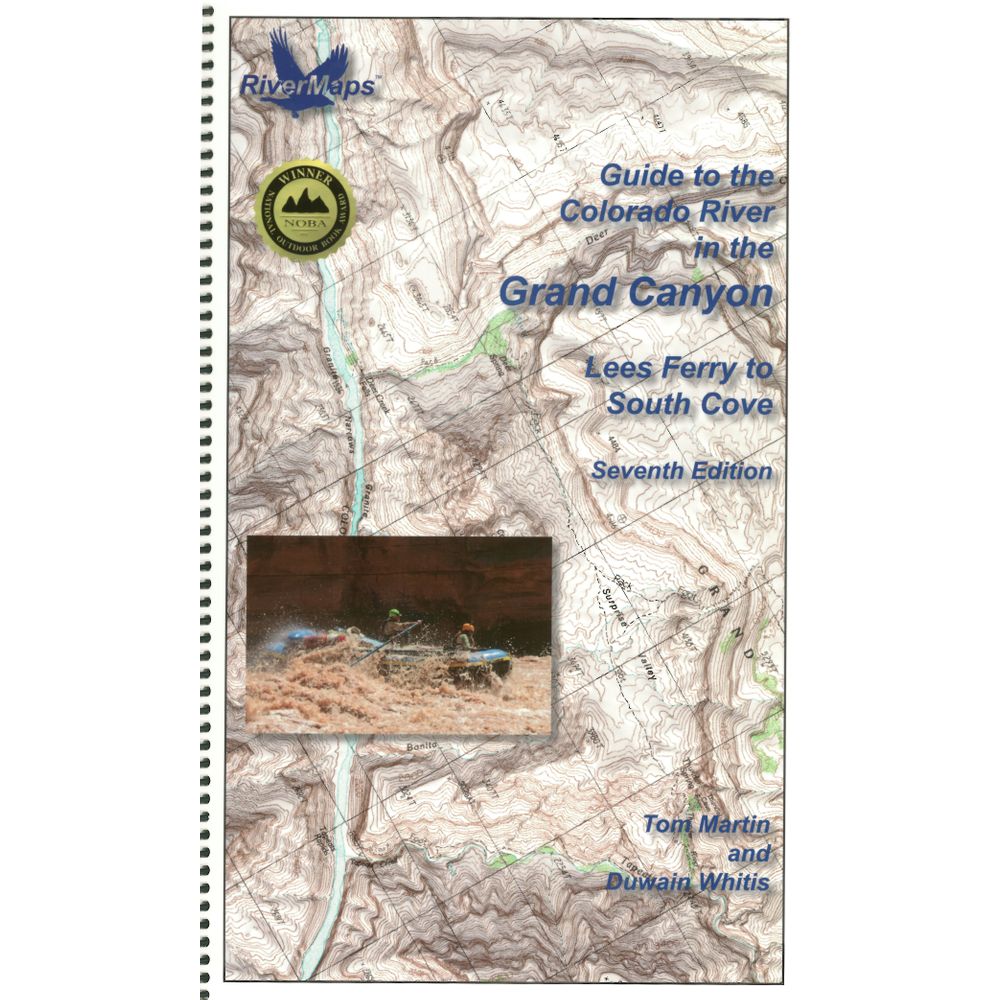
RiverMaps Colorado River in the Grand Canyon 7th Ed. Guide Book


This product is no longer available, but we’ve got more options for you:
Product Details
The RiverMaps Guide to the Colorado River in the Grand Canyon is a must-have guidebook for your trip down the Grand. The USGS topo maps are durable, waterproof and offer excellent descriptions of the river features.
Copyright: 2018
Size: 9" x 14"
Pages: 119
- This 7th Edition book covers the entire river, from the Lees Ferry launch site to the South Cove take out on Lake Mead with up-to-date data on camps and river features.
- Spiral-bound format with full-color topographical maps on the right side and complete text descriptions on the facing page.
- With book in hand, maps read from bottom to top to match the downstream flow of the river.
- High-quality waterproof paper prevents ink from smearing and is tear resistant to keep your guide intact throughout your trip.
- Relief shading of the topo map offers a much clearer perspective of the terrain.
- Excellent mile-by-mile information on rapids, campgrounds, geological features, historical sites and reference points.
- The topo maps are the same scale as the original USGS maps. The contour lines and accurate river shape enhances your ability to keep track of where you are.
Copyright: 2018
Size: 9" x 14"
Pages: 119
Specs
| Subject Matter: |
|
|---|---|
| Subject Location: | Southwest |
| Author: | Tom Martin & Duwain Whitis |
| Copyright: | 2018, 7th Edition |
| Size: | 9" x 14" |
| Pages: | 119 |
| Features: |
|


 NRS Gift Card: Always Fits, Always Wanted


