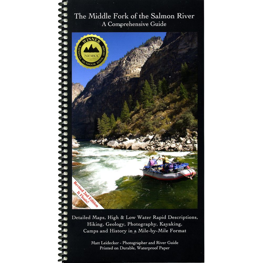
Middle Fork of the Salmon Guide Book


This product is no longer available, but we’ve got more options for you:
Product Details
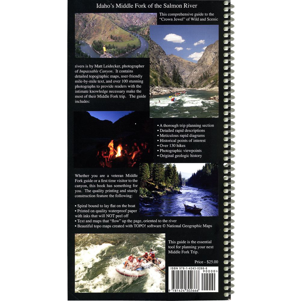
Matt Leidecker's Middle Fork of the Salmon River Comprehensive Guide gives you detailed topo maps, high & low water rapid descriptions, campsites, hiking and geology - in waterproof format.
Author: Matt Leidecker
Copyright: 2006
Size: 6" x 11"
Pages: 94 waterproof
- Spiral bound and printed on durable waterproof paper, this detailed 94-page guide gives you all the information you need for a successful Middle Fork trip.
- The color topo maps are created from the National Geographic TOPO software in 1:15,000 format with added rapid, camp and historical landmarks locations.
- Matt includes permit information, fishing, camping and other trip planning tips in the front of the guide.
- For you high tech folks, GPS coordinates are given for all campsite locations.
- Over 130 hikes are detailed and described.
- Sixteen pages of geologic history and mile-by-mile lists of creek blowouts and geologic events.
Author: Matt Leidecker
Copyright: 2006
Size: 6" x 11"
Pages: 94 waterproof
Specs
| Subject Matter: | Guidebooks |
|---|---|
| Author: | Matt Leidecker |
| Copyright: | 2006 |
| Size: | 6" x 11" |
| Pages: | 94 |
| Features: |
|
'%3e%3cg id='Final-Copy-2_2_' transform='translate(1275.000000, 200.000000)'%3e%3cpath class='st0' d='M7.4,12.8h6.8l3.1-11.6H7.4C4.2,1.2,1.6,3.8,1.6,7S4.2,12.8,7.4,12.8z'/%3e%3c/g%3e%3c/g%3e%3c/g%3e%3cg id='final---dec.11-2020'%3e%3cg id='_x30_208-our-toggle' transform='translate(-1275.000000, -200.000000)'%3e%3cg id='Final-Copy-2' transform='translate(1275.000000, 200.000000)'%3e%3cpath class='st1' d='M22.6,0H7.4c-3.9,0-7,3.1-7,7s3.1,7,7,7h15.2c3.9,0,7-3.1,7-7S26.4,0,22.6,0z M1.6,7c0-3.2,2.6-5.8,5.8-5.8 h9.9l-3.1,11.6H7.4C4.2,12.8,1.6,10.2,1.6,7z'/%3e%3cpath id='x' class='st2' d='M24.6,4c0.2,0.2,0.2,0.6,0,0.8l0,0L22.5,7l2.2,2.2c0.2,0.2,0.2,0.6,0,0.8c-0.2,0.2-0.6,0.2-0.8,0 l0,0l-2.2-2.2L19.5,10c-0.2,0.2-0.6,0.2-0.8,0c-0.2-0.2-0.2-0.6,0-0.8l0,0L20.8,7l-2.2-2.2c-0.2-0.2-0.2-0.6,0-0.8 c0.2-0.2,0.6-0.2,0.8,0l0,0l2.2,2.2L23.8,4C24,3.8,24.4,3.8,24.6,4z'/%3e%3cpath id='y' class='st3' d='M12.7,4.1c0.2,0.2,0.3,0.6,0.1,0.8l0,0L8.6,9.8C8.5,9.9,8.4,10,8.3,10c-0.2,0.1-0.5,0.1-0.7-0.1l0,0 L5.4,7.7c-0.2-0.2-0.2-0.6,0-0.8c0.2-0.2,0.6-0.2,0.8,0l0,0L8,8.6l3.8-4.5C12,3.9,12.4,3.9,12.7,4.1z'/%3e%3c/g%3e%3c/g%3e%3c/g%3e%3c/g%3e%3c/svg%3e) Your Privacy Choices
Your Privacy Choices NRS Gift Card: Always Fits, Always Wanted


